Resilience Planning: Chimney Rock
Hurricane Helene devastated Chimney Rock, NC in 2024, wiping out much of the town’s riverfront. Rather than prescribe a single solution, our project contributed to a broader community toolkit — a menu of implementable interventions the town could adopt piece by piece, on their own terms and timeline. Our section specifically focused on the corridor between the Chimney Rock Village Core and Lake Lure, prioritizing natural sports infrastructure, flood resilience, and ecological restoration along the Rocky Broad River.
Design team: Leah Ballou & Erik Darden — Spring Studio 2026, Lake Lure Connection
01
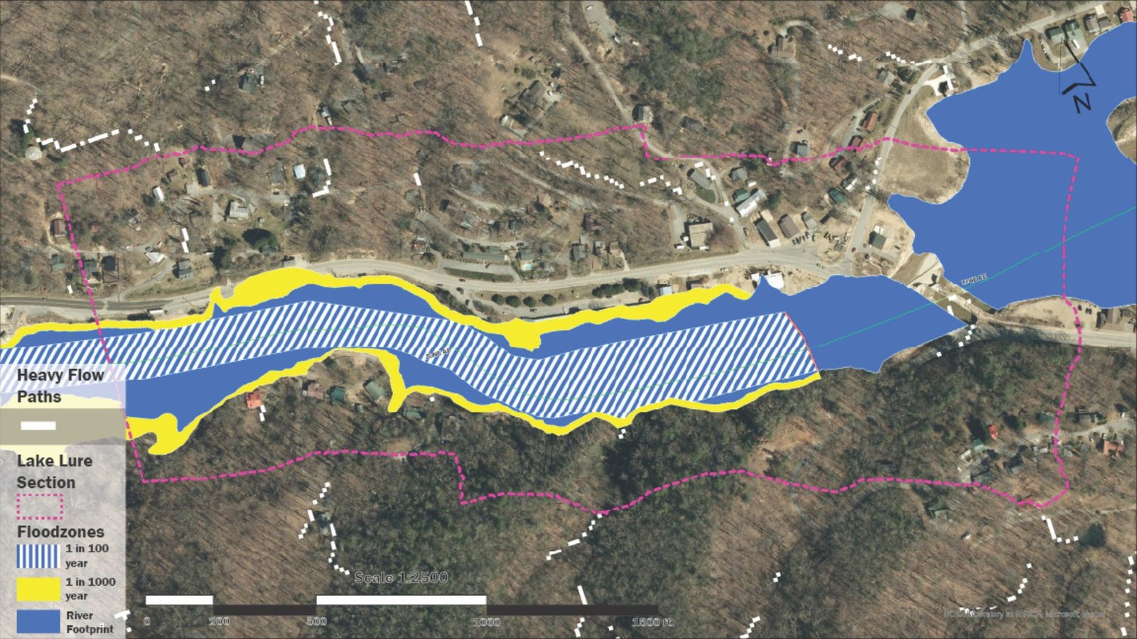
Understanding the Floodplain
Before designing anything, we needed to understand what Helene revealed about the land. This hydrological edge analysis maps the 1-in-100 and 1-in-1000 year flood zones alongside heavy flow paths and the river’s existing footprint. The overlap between the floodplain and the town’s main corridor made clear that any resilient design had to work with the river, not against it — treating flood-compatible programming and landscape systems as first principles rather than afterthoughts.
02
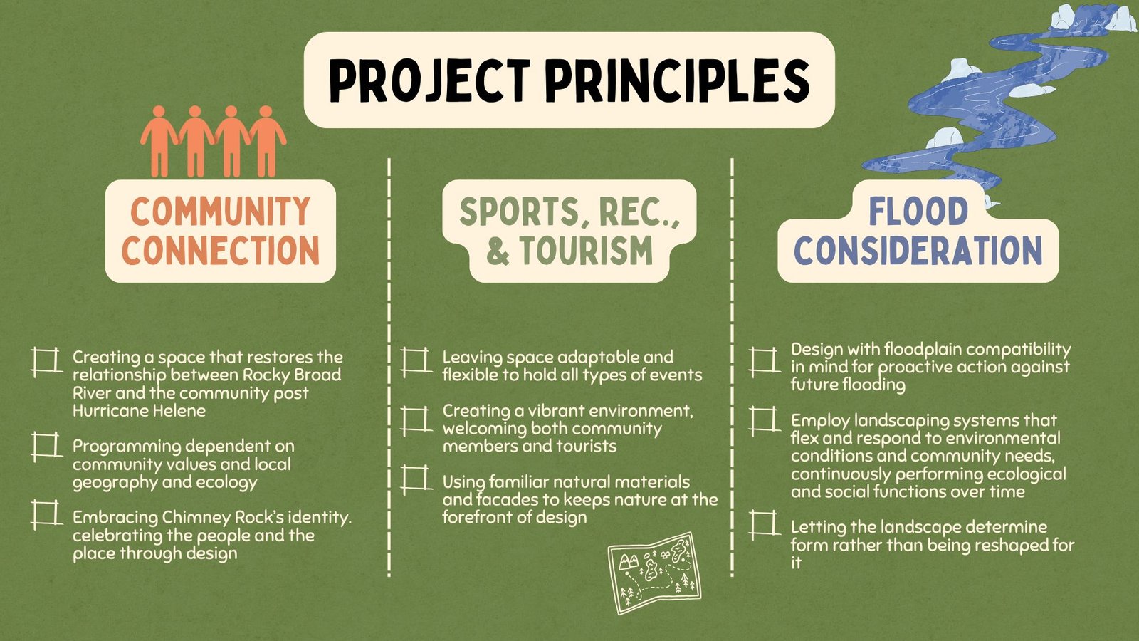
Three Pillars of Recovery
Our design framework was built around three interlocking principles. Community Connection — restoring the relationship between the Rocky Broad River and residents post-Helene, with programming rooted in local identity. Sports, Recreation & Tourism — creating flexible, nature-forward spaces that serve both the community and the outdoor recreation economy that Chimney Rock depends on. Flood Consideration — designing with floodplain compatibility built in, using landscaping systems that flex and respond to environmental conditions rather than resist them.
03
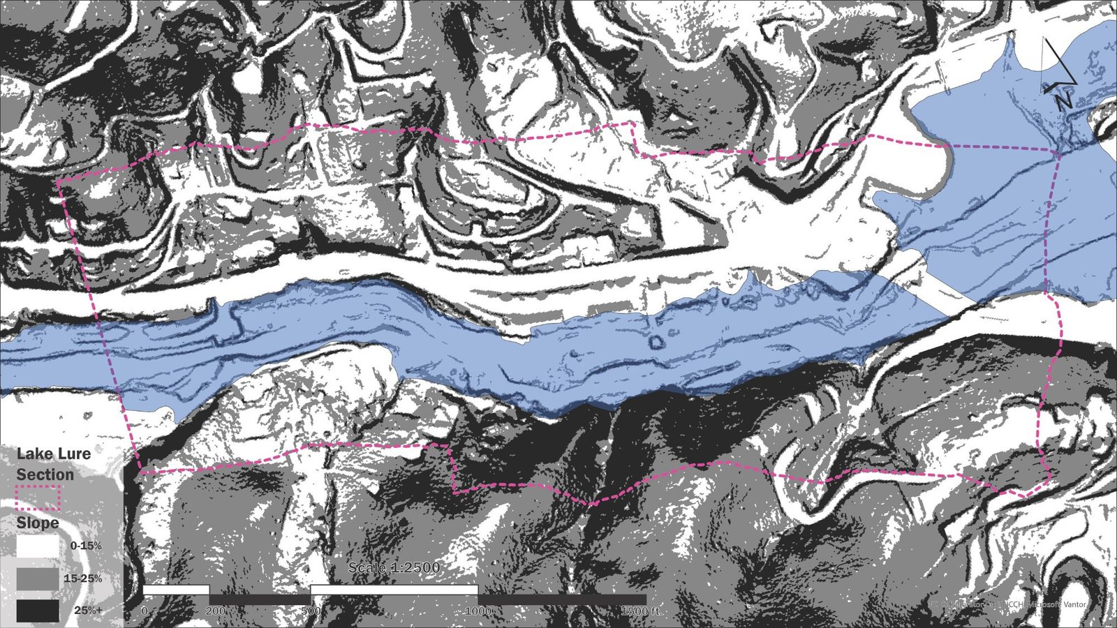
Topographic analysis — elevation and slope informing flood-compatible siting
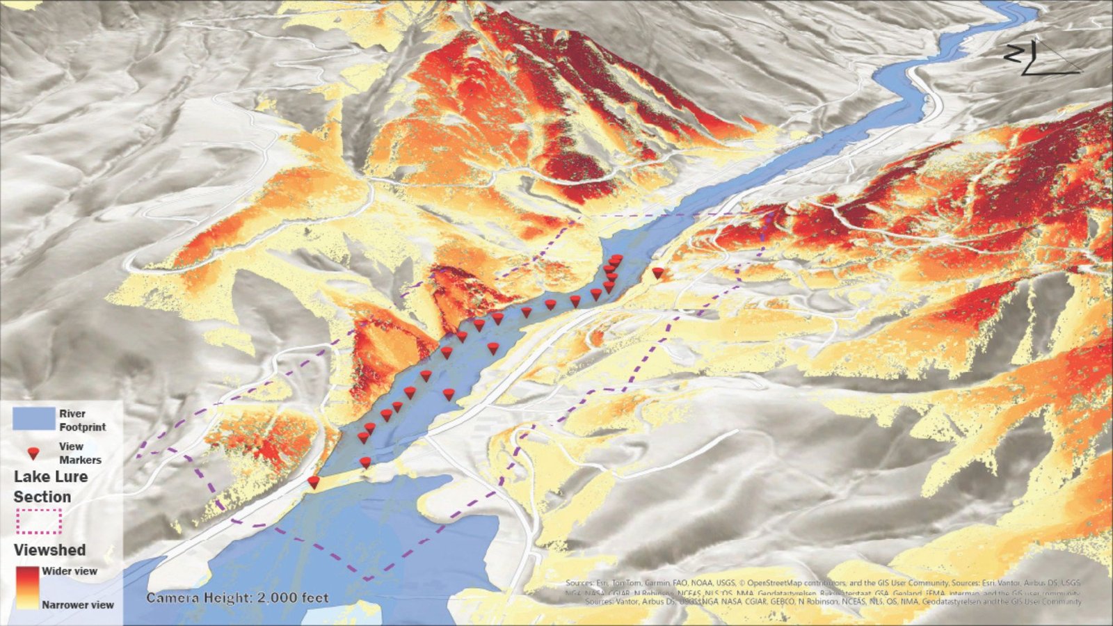
Viewshed analysis — identifying key visual corridors to Chimney Rock and the surrounding ridgeline
Reading the Landscape
GIS analysis was central to ground-truthing our design decisions. Topographic modeling revealed the steep slope transition from Highway 74 down to the river edge — informing the terraced access strategy in the masterplan. Viewshed analysis identified which programmatic nodes would maintain visual connection to the iconic Chimney Rock formation, reinforcing the site’s identity and tourism value. These maps were developed alongside in-person site visits and resident interviews to ensure the data reflected lived experience.
04
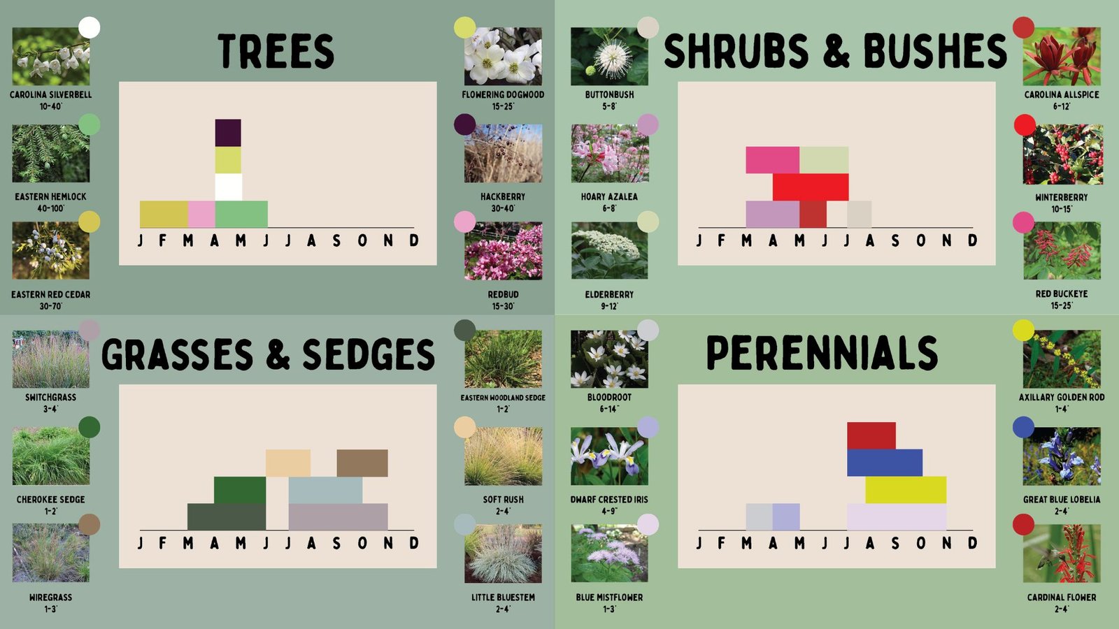
Ecological planting palette by Leah Ballou
Planting for Resilience
The planting palette was designed entirely around native Appalachian species selected for their ecological performance in riparian and disturbed post-flood conditions. Carolina Silverbell, Eastern Hemlock, and Redbud anchor the tree canopy. Buttonbush and Elderberry provide mid-story flood tolerance. Switchgrass, Cherokee Sedge, and Soft Rush stabilize the river edge while supporting habitat. Each species was chosen not only for aesthetics but for its ability to continuously perform ecological and social functions over time — a core principle of the toolkit approach.
05
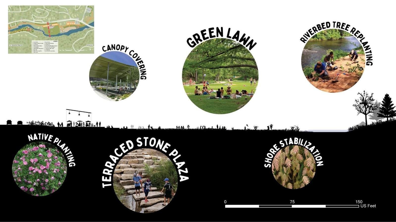
Site section showing the transition from Highway 74 through the mixed-use plaza, terraced access, and green lawn to the Rocky Broad River. In collaboration with Leah Ballou.
From Highway to River
This site section captures the essential spatial logic of the masterplan — a terraced descent from Highway 74 down through a mixed-use canopy plaza, past a terraced river access zone, and out to a flexible green lawn that meets the Rocky Broad at grade. Each layer serves a distinct programmatic and ecological function, and each can flood without compromising the others. The section reads as a diagram of the project’s core thesis: let the landscape determine form, and design infrastructure that performs even under extreme conditions.
06
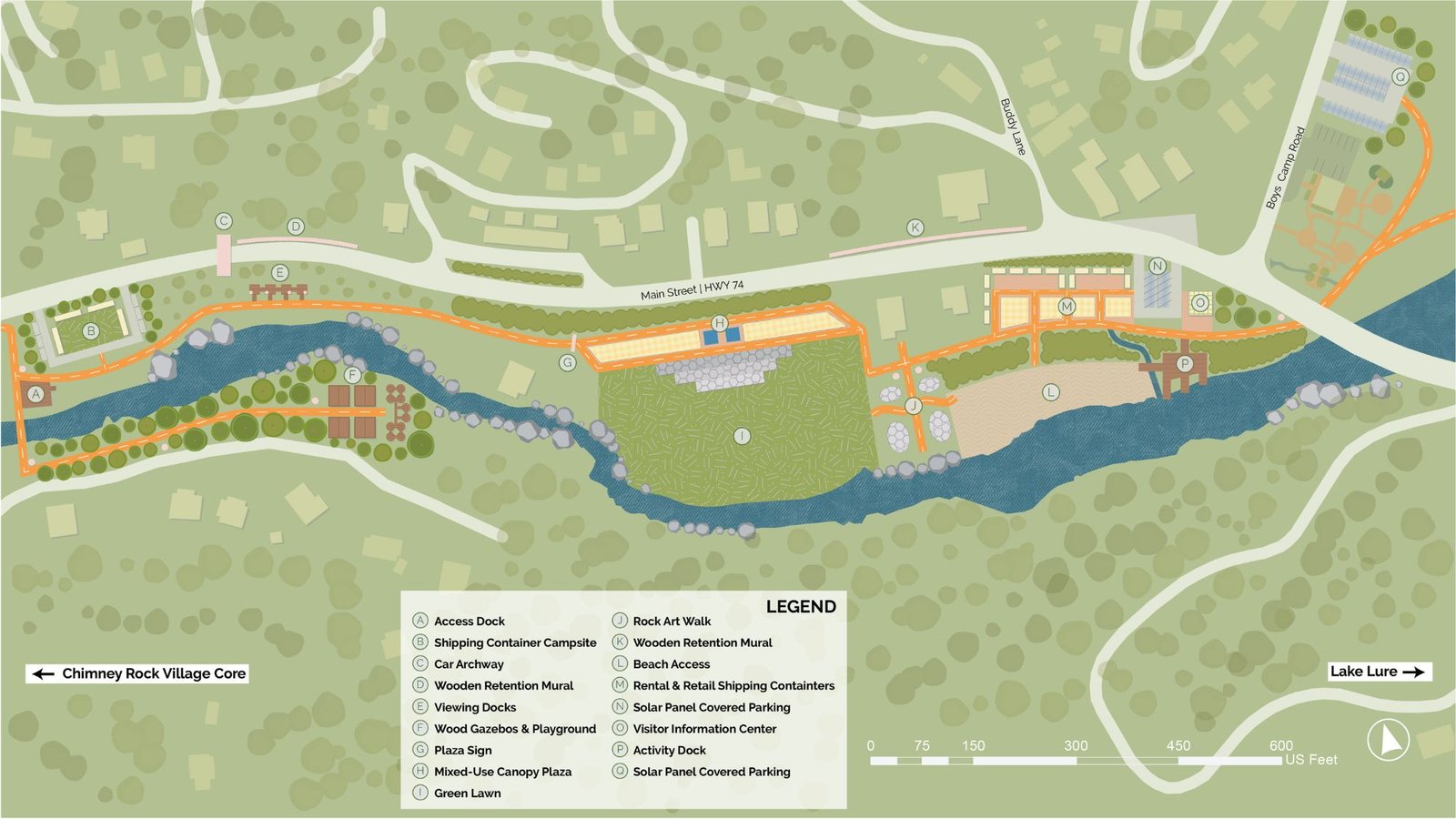
Masterplan by Leah Ballou & Erik Darden — Lake Lure Connection section, Spring Studio 2026
The Lake Lure Connection Masterplan
The masterplan covers the corridor between the Chimney Rock Village Core and Lake Lure, organized as a sequence of nodes along the Rocky Broad River. Key elements include shipping container campsites and an access dock at the western end, a mixed-use canopy plaza and green lawn at the central zone, rock art walks and wooden retention murals along the river edge, and solar panel covered parking and a visitor information center at the eastern gateway to Lake Lure. Each element is designed to be implemented independently, giving the town flexibility to phase the project according to available resources — the toolkit principle made spatial.
07
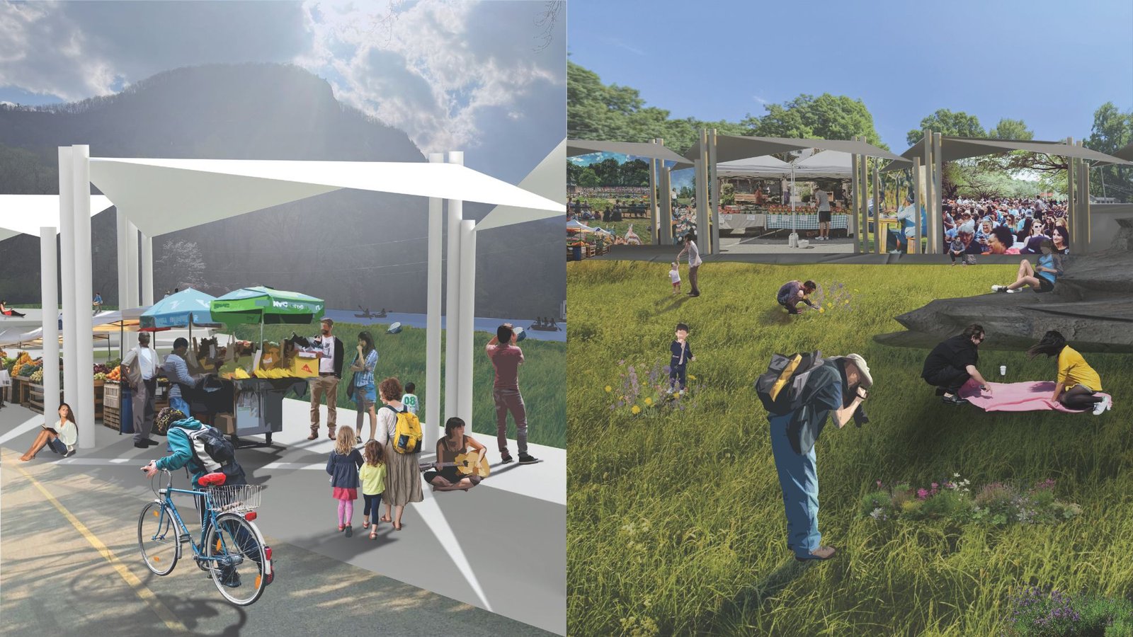
A Vision for Activation
These renderings illustrate the two faces of the central zone. On the left, the mixed-use canopy plaza activates as a farmers market and community gathering space — a covered, flexible structure that welcomes cyclists, families, and vendors while keeping the mountain backdrop present. On the right, the green lawn serves as a naturalistic gathering meadow that steps gently to the river’s edge, programmed for passive recreation, events, and seasonal flooding. Together they embody the project’s vision: infrastructure that gives Chimney Rock back its riverfront, on terms the community can own.