Accessible Greenways: Theory vs. Reality
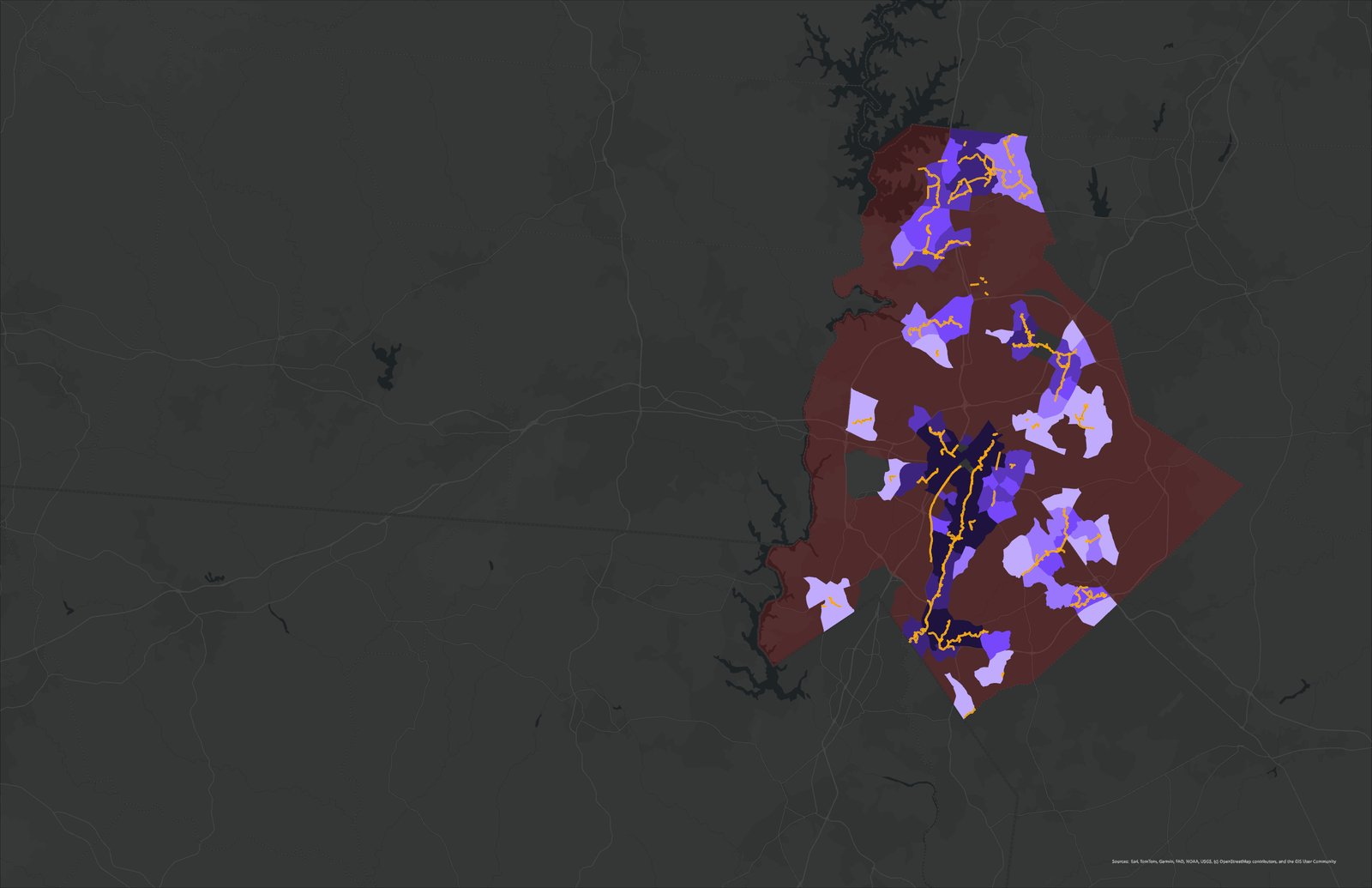
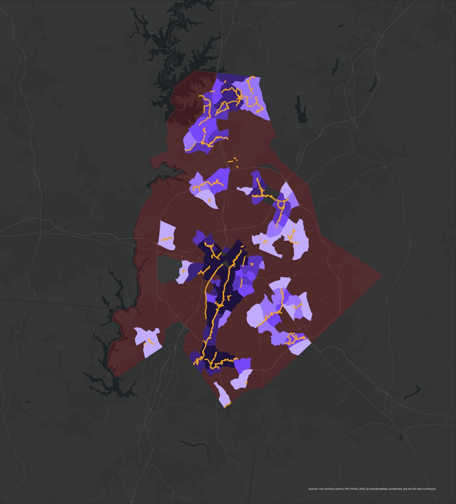
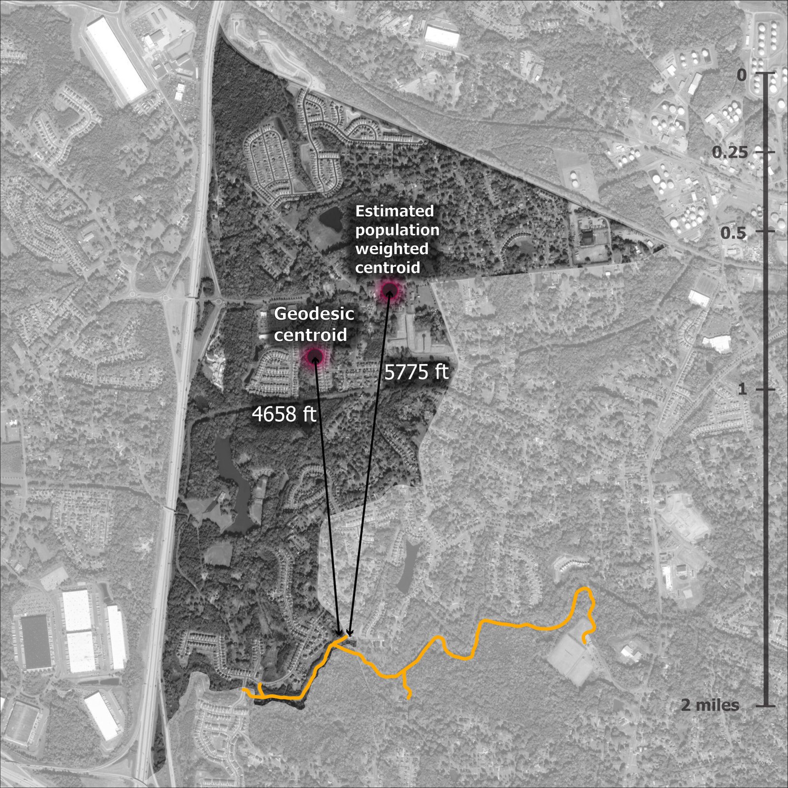
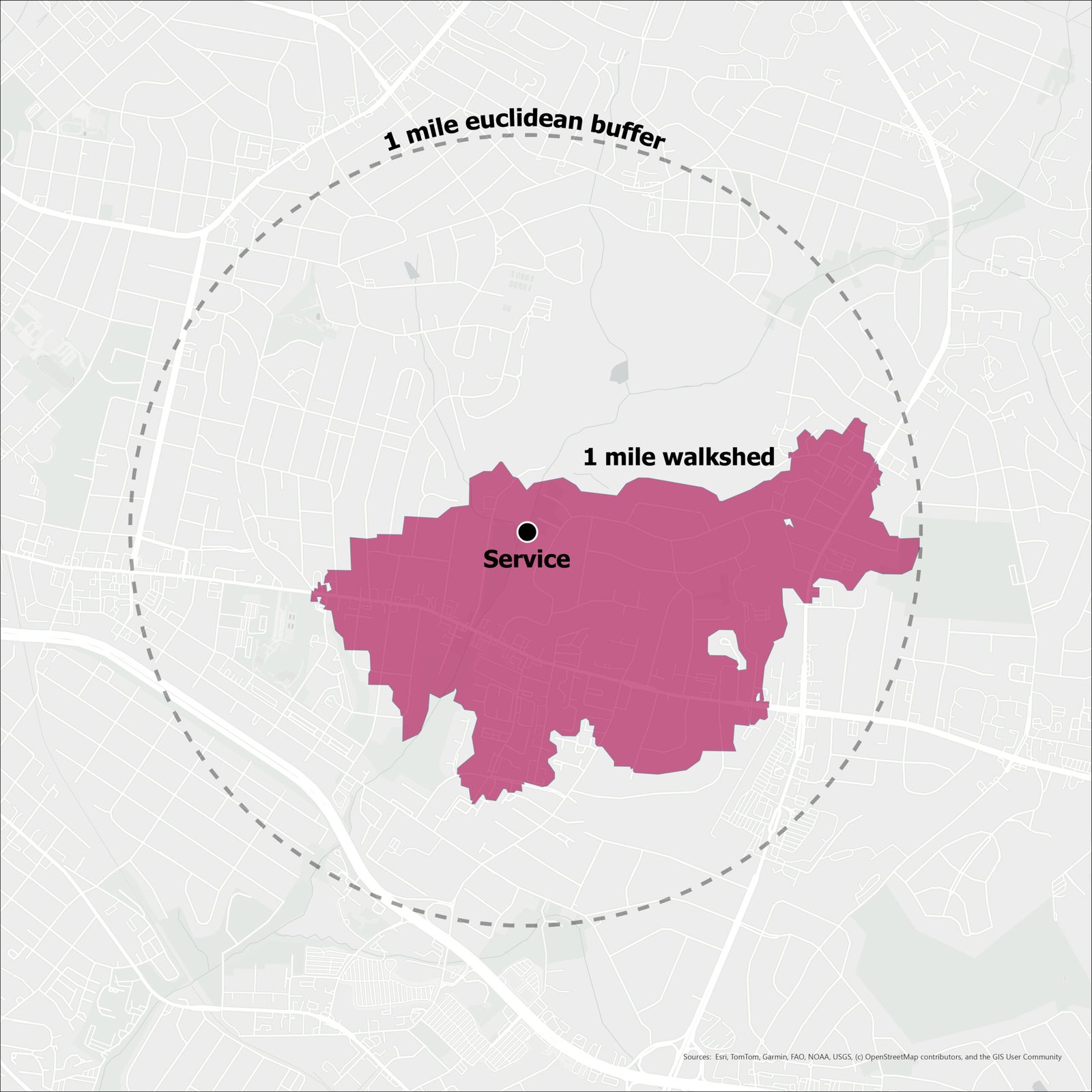
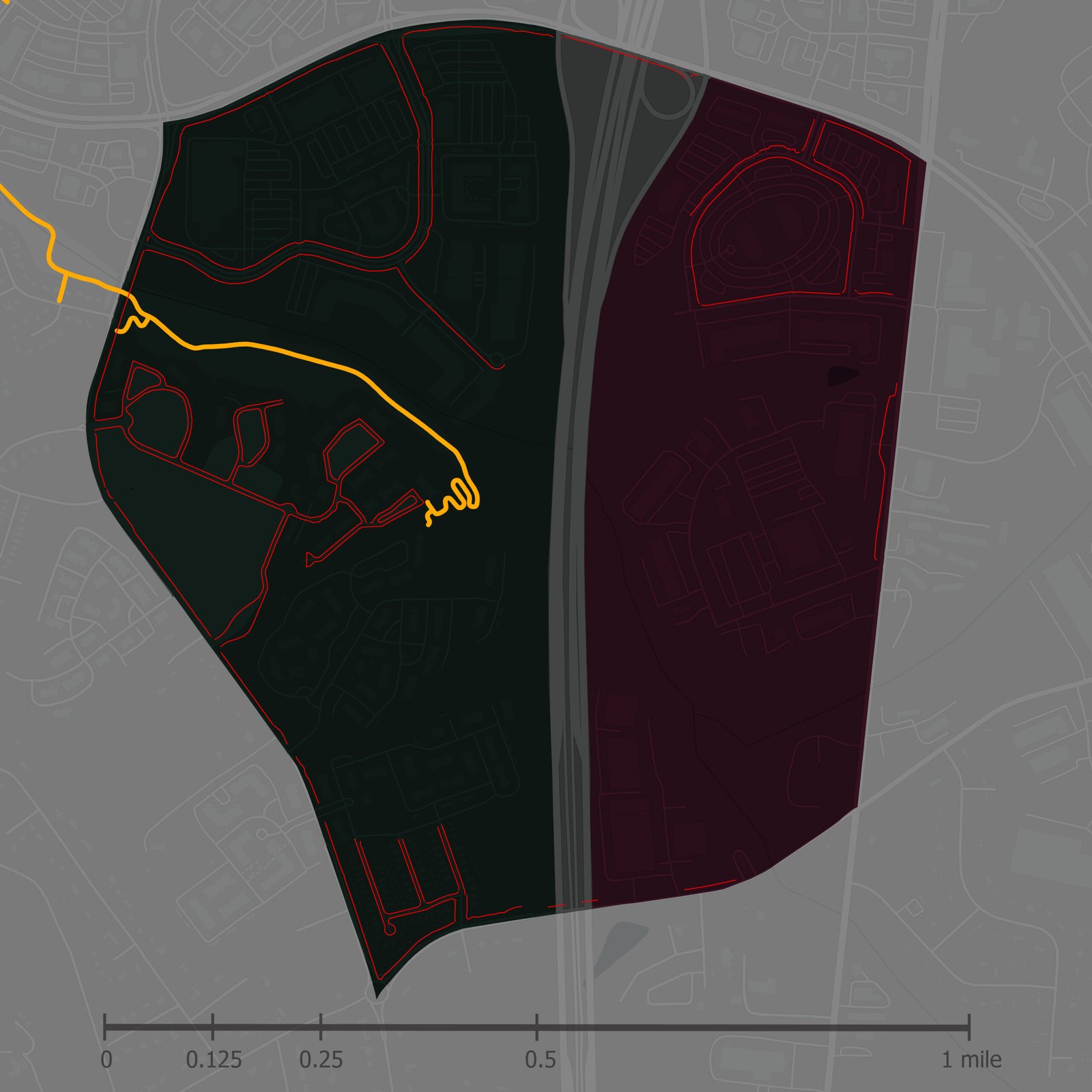
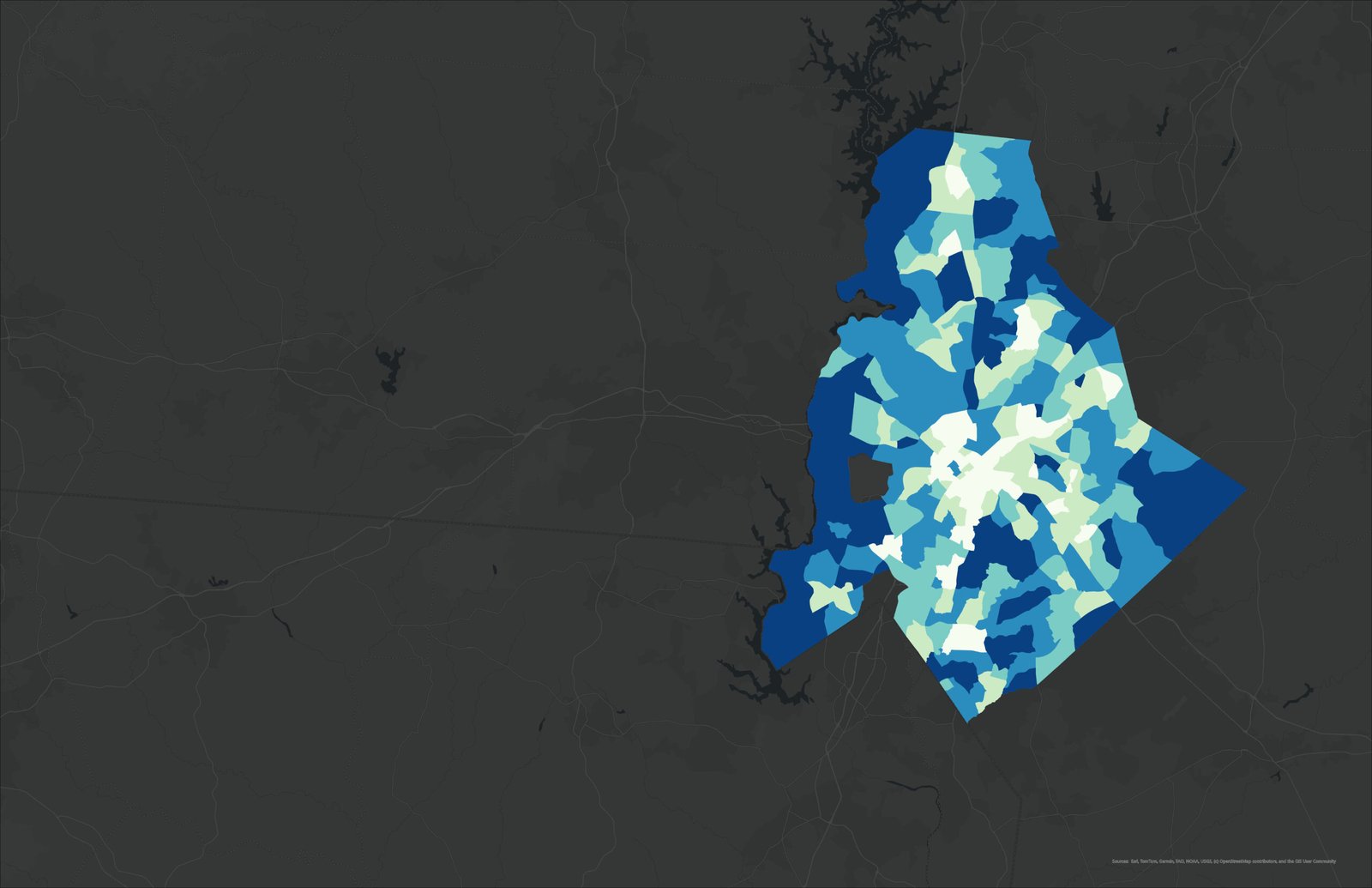
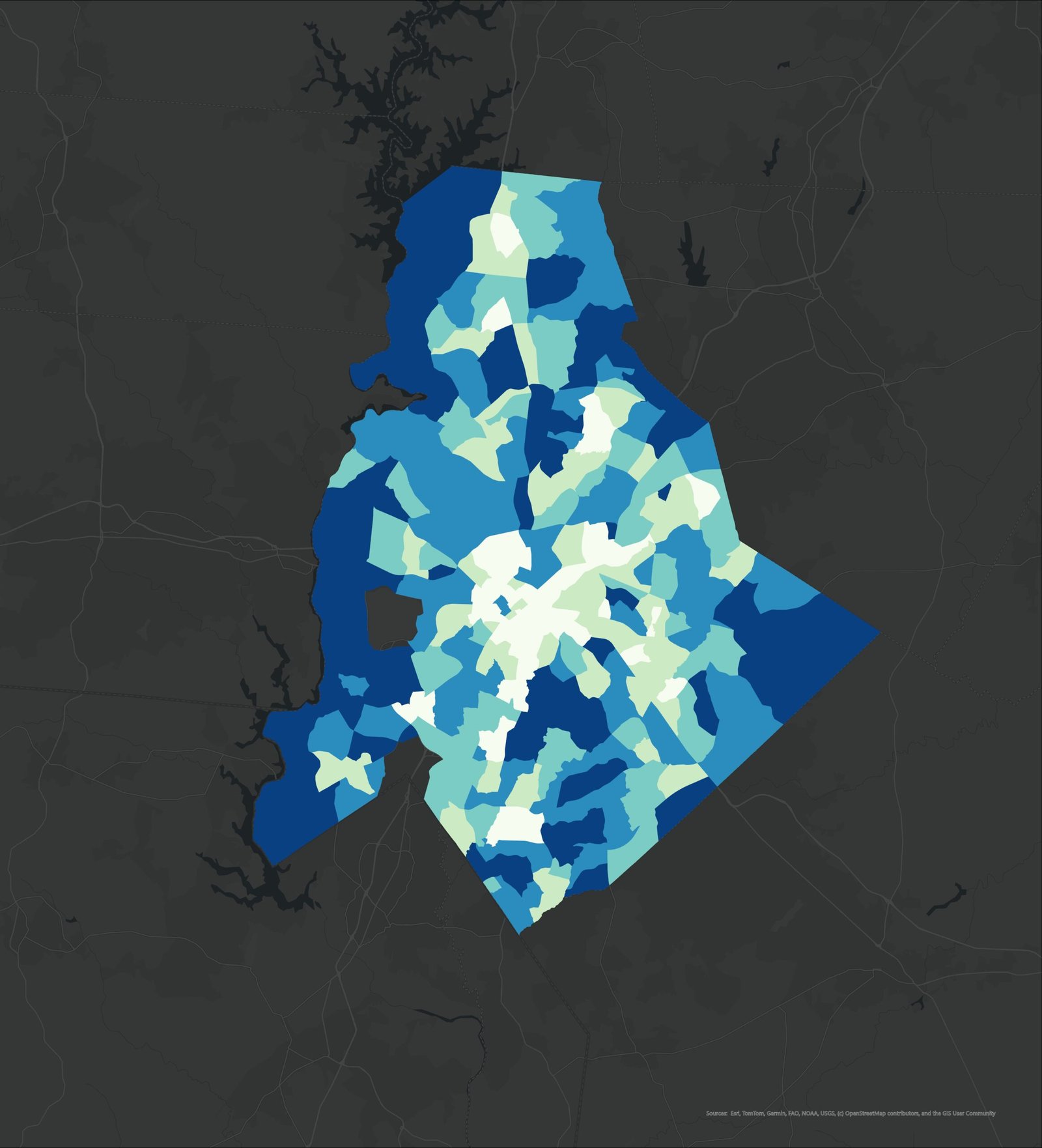
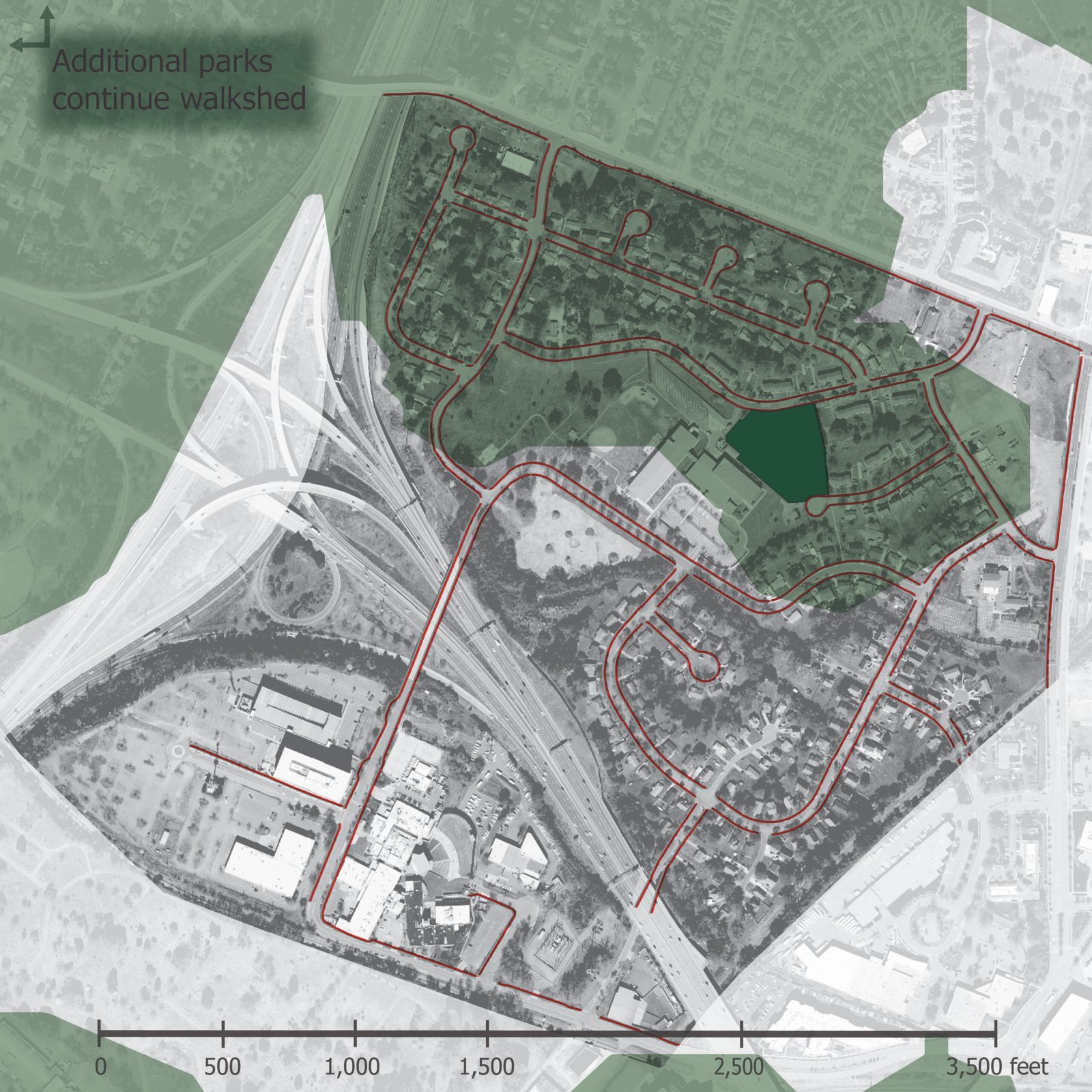
A multi-method analysis was conducted to assess greenway accessibility and its relationship to population health outcomes in Charlotte. Accessibility was quantified using a floating catchment area (FCA) model, generating a supply-to-demand ratio based on greenway area and population within a one-mile threshold. The analysis revealed a highly skewed distribution, with most tracts exhibiting no measurable access and higher values concentrated near core corridors. The results and limitations of the study sparked a hypothesis that proximity to green space may be dependent on sidewalk connectivity and other built environment features in order to impact health.
Reflections on Methodology
The study’s limitations became the question.
Each diagram below traces a gap in the original model — and the reasoning that drove a more rigorous second analysis.
Part 2: Infrastructure as Intervention
The findings of the initial greenway accessibility research prompted a hypothesis: Greater park access is associated with lower obesity prevalence after accounting for neighborhood demographic and accessibility factors, particularly sidewalks. Thus, a secondary statistical analysis examines associations between accessibility and obesity prevalence, exploring the idea that limited proximity to parks and greenways may be linked to adverse health outcomes. These findings underscore the importance of integrating spatial accessibility metrics into public health and planning frameworks.
Project team: Mann Patel, Jackson Plemmons, Sydney Stine, Erik Darden
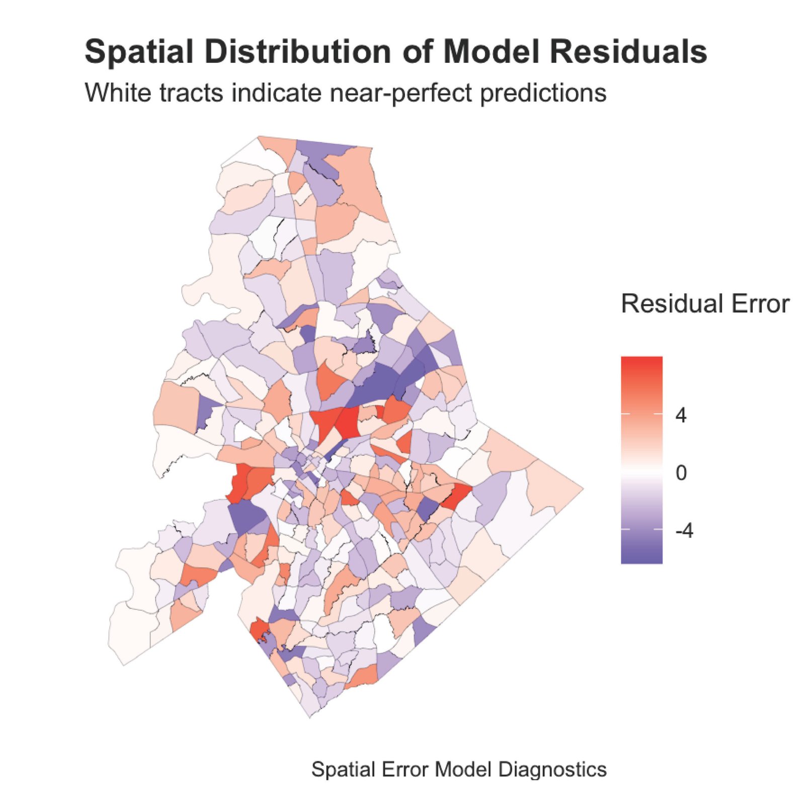
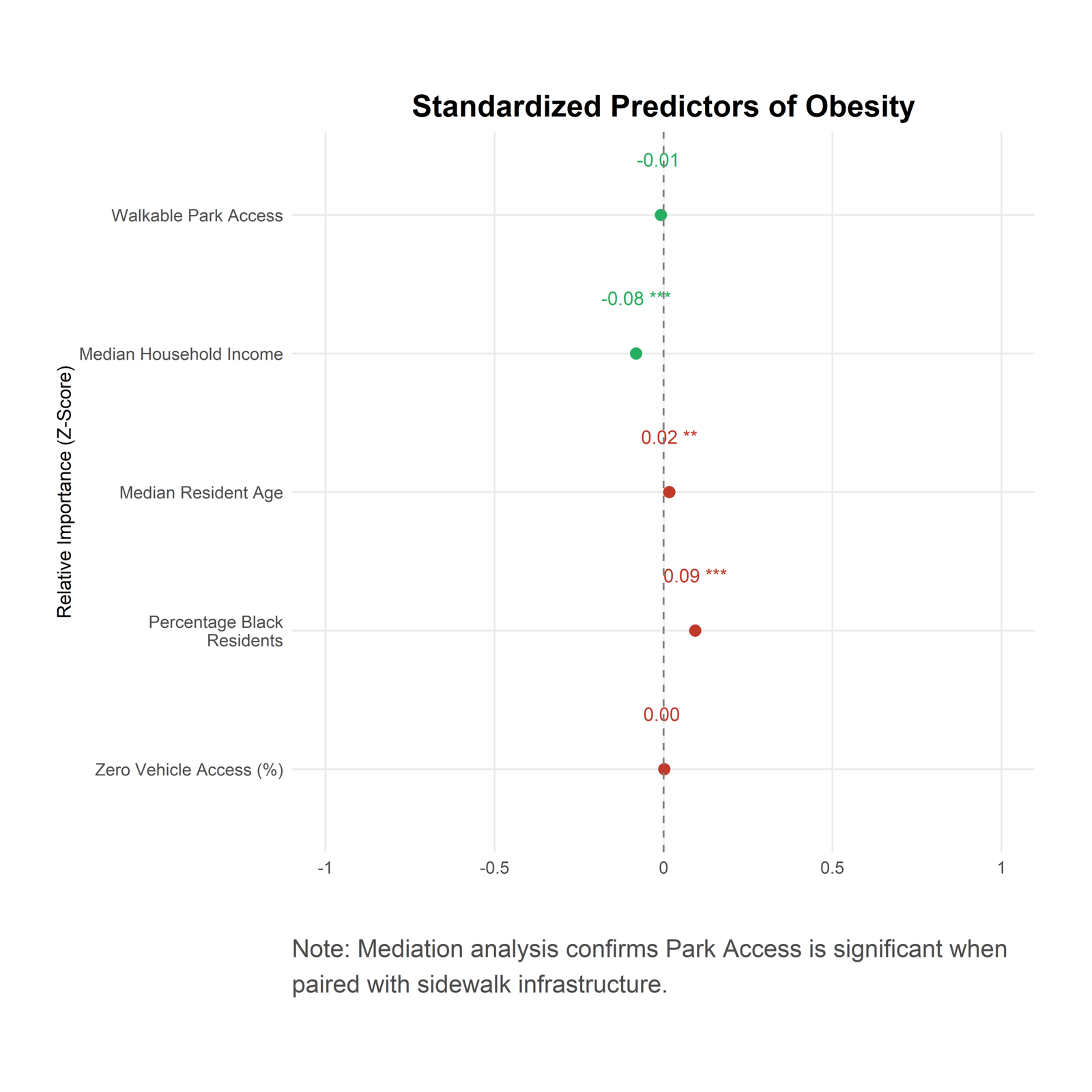
Key Insight: Further mediation analysis revealed that park access becomes a significant protective factor only when modeled through the pathway of safe pedestrian (sidewalk) infrastructure.