Patching a Torn Urban Fabric
“Connect and Fill” examines the legacy of Charlotte’s Brooklyn — once a dense, walkable, and self-sustaining Black neighborhood — that was largely erased by mid-20th-century urban renewal. The project proposes a restorative urban design strategy that reconnects the street grid, replaces underutilized surface lots with housing, and prioritizes human-scaled density to address long-standing inequities.
Design team: Ellie New, Erik Darden, Amanda Marais, Gabby Pace
01
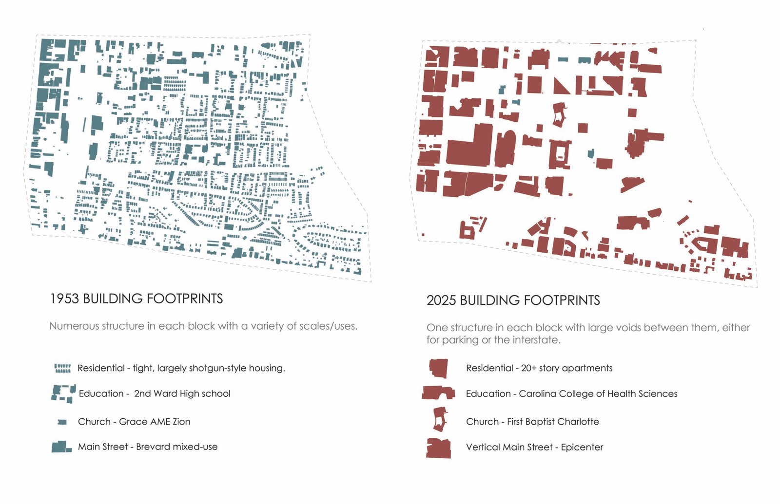
Building data collected by me; graphic produced by Amanda Marais
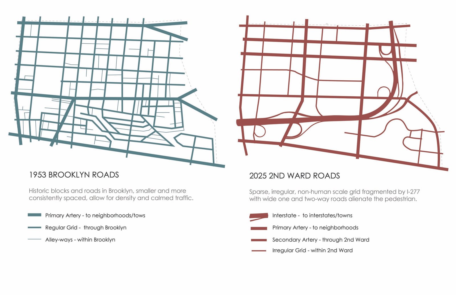
Street data collected by me; graphic produced by myself and Amanda Marais
The Erasure of the Urban Fabric
These diagrams reveal the stark transformation of Brooklyn/Second Ward from a dense, walkable 1953 street grid into today’s fragmented, car-oriented landscape. By comparing historic block structure, street continuity, and building footprints, the analysis makes visible how I-277, surface parking, oversized parcels, and single-use development erased much of the neighborhood’s original human-scaled urban fabric. The findings directly informed the Brooklyn Village design strategy by highlighting where smaller blocks, restored street edges, mixed-use anchors, and pedestrian-scaled infill were most needed.
02
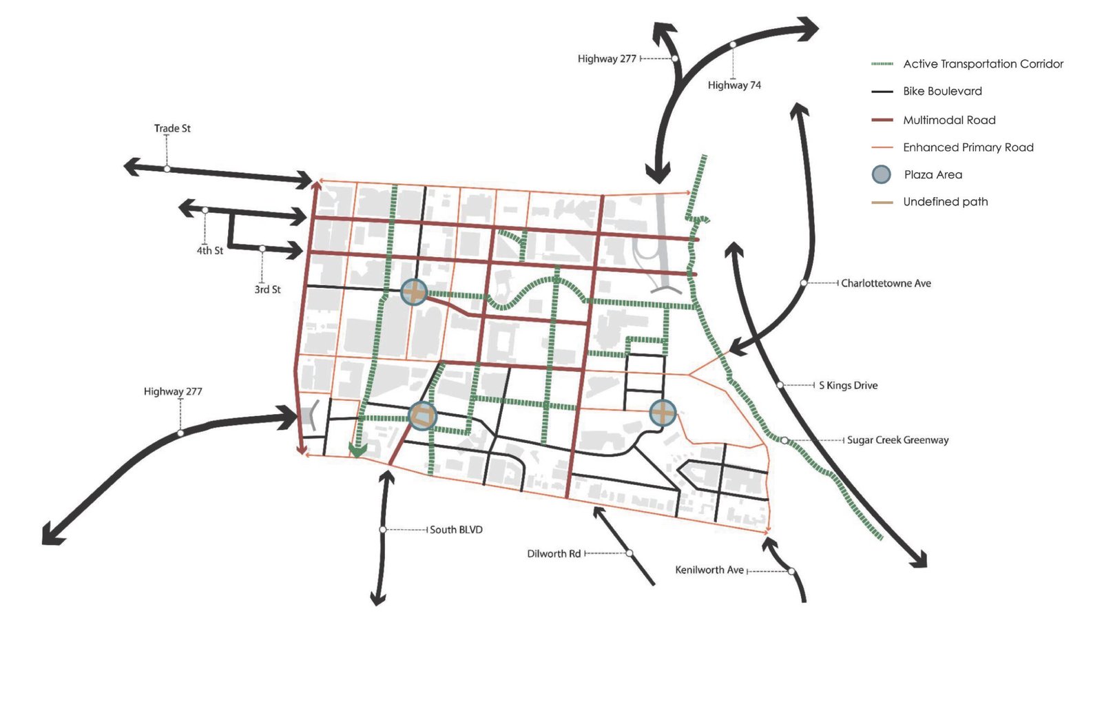
Plugging into Charlotte’s Network
Despite proximity to the LYNX Blue Line, the Gold Line streetcar, and the Sugar Creek Greenway, the site currently functions as an isolated island. By rewriting the script of urban mobility design, we created a transportation network which prioritizes safety and comfort regardless of travel mode. Pedestrian and personal mobility device pathways reduce conflict areas and lower vehicle dependency. Burying the second ward segment of I-277 allows us to connect to the rest of historic Brooklyn and loosen the noose of an impermeable highway.
03
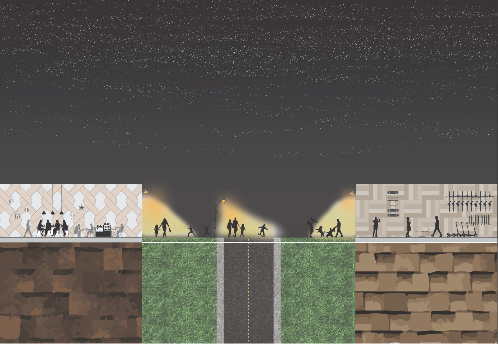
Reimagining the Street Section
This street section illustrates the transformation of a car-centric Second Ward corridor into a lively, activated public realm. By redistributing right-of-way away from vehicles and toward people, the design introduces dedicated pedestrian-only pathways, protected cycling infrastructure, and planted buffers that encourage spontaneous street life. The proposal directly responds to the neighborhood’s history of disinvestment in non-vehicular infrastructure — rebalancing the street as a shared civic space that prioritizes safety, comfort, and accessibility across all modes of travel.
03
I contributed to the drafts, sketches, and iterative design process with the rest of the design team. Final graphic was created by Amanda Marais.
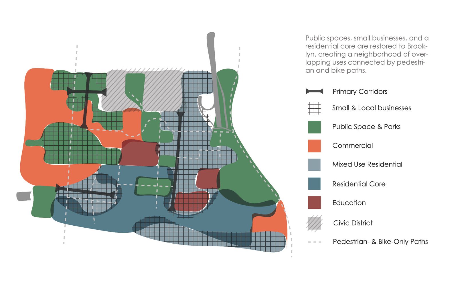
The Final Synthesis: Connect and Fill
The final framework is divided into two primary restorative actions. First, Connect: restoring the street grid and introducing the I-277 cap to reunify severed quadrants. Second, Fill: replacing surface parking “voids” with human-scaled, mixed-use density and diverse housing models like “Flexidential” and “Triple Decker” units. This strategy re-fills the urban fabric with the social scaffolding necessary for a thriving, equitable neighborhood.